The Erie Canal Towpath as a Way of Life in Pittsford Village
The Short Version
- The Erie Canalway Trail through Pittsford is part of a 360-mile route from Buffalo to Albany — the longest multi-use recreational trail in the United States, completed in 2020.
- The section through Pittsford is almost entirely off-road and car-free, which sounds ordinary until you've tried to find that combination anywhere else within 50 miles.
- The trail is flat because the canal required a level channel along its entire length — a 200-year-old engineering decision that makes this one of the most accessible recreational corridors in the region.
- From the kitchen window, I've watched this towpath in every season for years: the morning runners, the cyclists, the families with strollers, the occasional great blue heron standing exactly where you'd expect one.
- In fall the canal is at its best — the water level drops, the light goes golden, and the crowds thin just enough to remember that this place belongs to everyone who shows up for it.
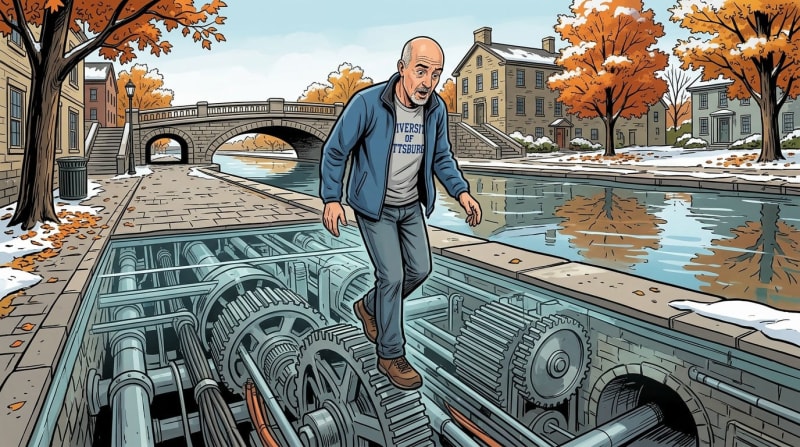
- The Great Embankment east of Schoen Place is one of the most underappreciated engineering landmarks in western New York — an earthen dam 70 feet high that still carries the canal above the valley floor.
What You're Walking On

What You're Walking On
The towpath running through Pittsford Village is part of the Erie Canalway Trail, which extends 360 miles from Buffalo to Albany as part of the Empire State Trail — completed in 2020 as the longest multi-use recreational trail in the United States (New York State Canal Corporation, 2020). The section through Pittsford is among the most heavily used stretches anywhere on the system, and for good reason.
The trail here is almost entirely off-road. From Pittsford west toward Rochester and east toward Fairport, roads cross over the canal rather than intersecting with it, which means you can walk or ride for miles without encountering a car. That's unusual. Across most of the Empire State Trail, road crossings break the rhythm constantly. Not here. Here the trail is a continuous, flat, car-free corridor running through the middle of a functioning village — a rarer amenity than people realize until they've lived somewhere without it.
The surface through the village is mostly paved asphalt, transitioning to compacted stone dust east of Schoen Place toward the Great Embankment (Empire State Trail, New York State Office of Parks, Recreation and Historic Preservation, 2020). The grade is flat throughout — a consequence of the canal's original engineering, which required a level channel along its entire length. That flatness makes it accessible to nearly everyone: young kids on bikes, older adults walking, runners putting in mileage, people with strollers. I've seen all of it out there on any given morning, from the kitchen window and from the water.
The Engineering Underneath
The Engineering Underneath
Most people who walk this trail have no idea what they're walking over, which is a shame, because the ground beneath their feet is among the more extraordinary pieces of civil engineering in American history.
The Erie Canal through Pittsford was opened in 1822, three years before the full canal from Buffalo to Albany was completed (Town of Pittsford, 2022). The portion of the route east of the village — now Great Embankment Park — required solving a problem that nearly stopped the entire project: how to cross the deep valley carved by Irondequoit Creek without adding 150 feet of lockage on either side.
The solution was the Great Embankment: a mile-long earthen berm, 76 feet above the creek, with Irondequoit Creek routed underneath through a 245-foot culvert dug into the bedrock below (Erie Canalway National Heritage Corridor). The engineers — most of them self-taught; there were no formal civil engineers in the United States at the time — hauled fill from miles away, drove more than 900 twenty-foot pilings into unstable soil, and finished the entire structure in a single construction season in 1822 (Perinton Historical Society). When the Marquis de Lafayette traveled the route two years later, he reportedly described the canal as pursuing "an aerial route." He wasn't wrong. From that elevation, the valley below simply disappears.
The Lafayette quote and the "900 pilings" figure appear in multiple local historical sources but would benefit from confirmation through the Pittsford Town Historian's office or Historic Pittsford before publication.
That embankment is still there. You can walk across it on the towpath, 200 years after it was built, and watch Irondequoit Creek flowing underneath you in the valley below. From the water — from the Lake Lounger, heading east toward Bushnell's Basin — you can feel the embankment's scale differently. The canal narrows and the banks rise. The surrounding landscape drops away. Most people strolling past with their dogs don't know they're on it. From the boat, it's harder to miss.
This matters beyond trivia. The Great Embankment is evidence of what Pittsford's relationship with the canal actually is: not decorative, not incidental, but foundational. The village exists in its current form because this improbable earthwork made it possible for the canal to pass through here. Everything that came after — the warehouses on Schoen Place, the commercial activity, the growth — traces back to that.
Life on the Water

Life on the Water
There's a version of the canal that belongs to the towpath, and a different version that belongs to the water itself. I've spent enough time in both to say they're genuinely different experiences.
From the dock, the canal looks nothing like it does from shore. The perspective is lower. The noise of Monroe Avenue disappears almost immediately once you're out. What you hear instead is the canal's own sounds: the faint hum of the electric motor, water moving against the hull, herons doing what herons do along the far bank. Occasionally a CSX freight train rolls over the bridge just to our east, which is loud and brief and somehow fits.
The Lake Lounger runs on an electric motor recharged entirely from solar panels. There's no exhaust smell, no fuel to deal with, no noise beyond the water itself. This matters more than it might sound. The canal is a quiet place by nature — dug before the internal combustion engine existed, built for the slow pace of mule-hauled barges — and an electric boat respects that in a way a gas engine doesn't. When we're moving, we're moving at roughly the pace of a fast walk. When we cut the motor, we're just floating.
Our standard run is from the dock west to the Mitchell Road bridge — a short cruise that takes you past the back of the Del Monte, through the heart of Schoen Place, and out to where the canal widens near Carpenter Park at the Port of Pittsford. On summer evenings when the Town runs its concert series at Carpenter Park, you can hear the music before you see the crowd. The sound comes across the water before it reaches the shore.
Lock 32 Brewing Company — the brewpub built into the historic Schoen Place canal buildings — has dock tie-ups on the water side. We use them. You pull up, tie off, walk in. It's a reasonable argument for living this way: a cold beer reachable by boat, about twelve minutes from the dock. From the water, the Schoen Place buildings reveal themselves differently than from the towpath side — you see the canal-facing walls that the barges once loaded against, the scale of the old warehouses from the angle they were meant to be seen.
On evenings when there's live music at the Port of Pittsford or spilling out from the patio at Lock 32, floating along Schoen Place from the water is something I'd have trouble describing to someone who hasn't done it. The music reaches you a beat late. People on the towpath and at the outdoor tables are facing the bands; you're behind them, watching from the canal, separate from the event but fully inside it. It's its own kind of belonging.
What 200 Visits a Year Teaches You

What 200 Visits a Year Teaches You
A tourist who does the towpath once sees something. A resident who does it 200 times a year — and lives on the water — learns something different.
You learn the canal as a social space. The same faces appear with enough regularity that you start to know people by their schedules, their dogs, their pace. There's an informal community on that path. People nod. They stop to talk. A woman I've seen most mornings for years — I know her dog's name and her approximate opinions on everything the village does or doesn't do. I don't know her last name.
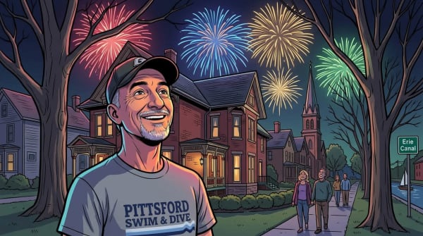
You learn the rhythms of the navigation season. In late spring, when the canal opens for navigation around mid-May, there's a particular quality to the light on the water early in the morning. The New York State Canal Corporation typically targets mid-May for navigation opening, but actual dates vary by year — confirm against the current NYS Canals schedule. Boats start appearing. Pleasure craft, the occasional houseboat, kayakers working east toward Fairport. By Memorial Day weekend, the Paddle and Pour festival fills Carpenter Park with people and music, and the canal becomes the center of everything for a day (Town of Pittsford, 2025).
Summer is the obvious season. Schoen Place tables fill by noon. The Sam Patch departs for its 90-minute narrated cruise through Lock 32, carrying more than 11,000 people a year from all 50 states, according to Corn Hill Navigation. Families with kids, couples, visitors from everywhere. The towpath is busy enough that you give the right-of-way on instinct. From the water, you wave at the Sam Patch passengers as they go through, and they wave back, which is a small and repeatable pleasure.
What a single visit cannot teach you is how the place changes, and what those changes mean.
The Canal in Fall

The Canal in Fall
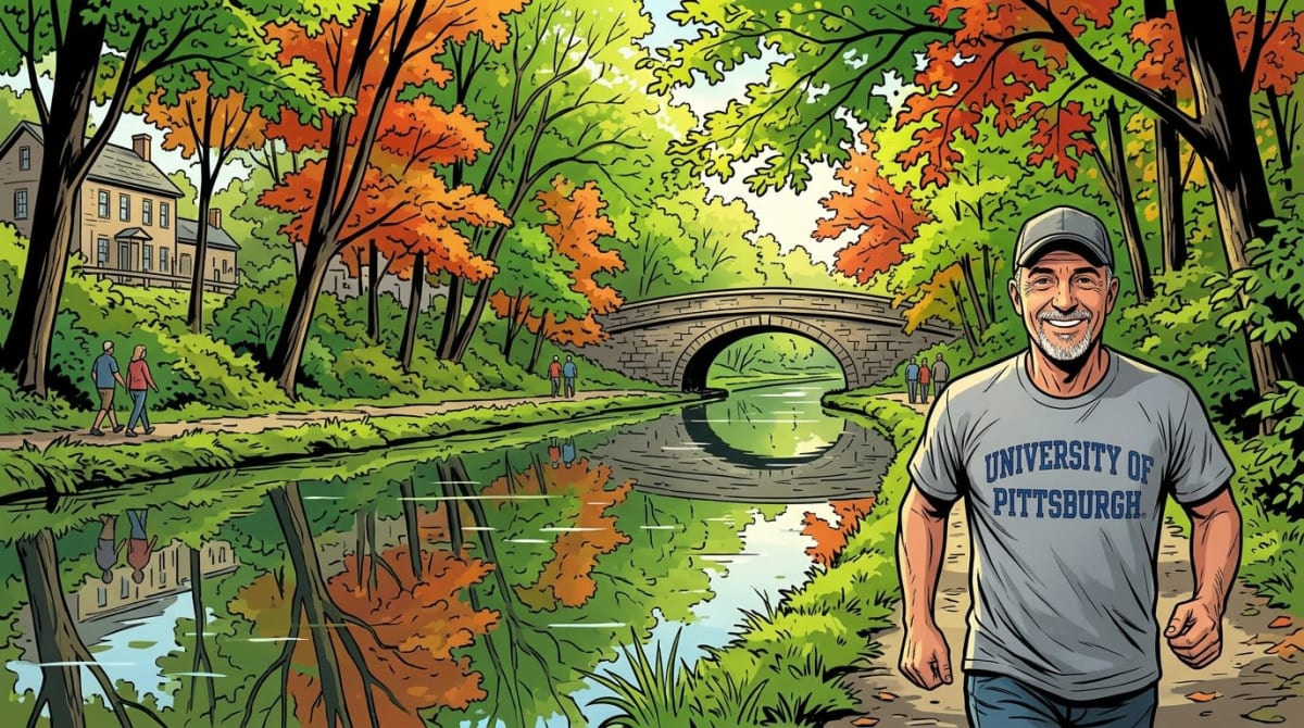
September and October are, in my view, the best months — on the path and on the water.
Navigation season winds down. Boat traffic thins. The path loses some of its summer crowd but keeps the regulars. The light on the water in October is different from any other month — lower, more horizontal, hitting the surface at an angle that makes everything look slightly older. On the water, the canal feels more like itself in fall: quieter, less performed.
Pittsford Farms Dairy's apple cider finds its way into the Schoen Place ecosystem. Powers Farm Market on Marsh Road, a few minutes' ride east of the canal, opens for its fall season with a dozen apple varieties, hayrides, and the kind of organized autumn kitsch that somehow still works (Powers Farm Market). The Sam Patch adds fall foliage cruises with cider and donuts from Powers on board, which is a combination that requires no defense.
The Great Embankment section east of the village is particularly striking in October. The deciduous trees go through their full range, and because the trail is cut through a corridor rather than open terrain, you're walking inside the color rather than viewing it from a distance. Worth making the effort even if you're not a regular trail user.
The canal typically closes to navigation by mid-November, drained and winterized by the New York State Canal Corporation. We haul the Lake Lounger out of the water in October, cover it, and the dock sits empty for the winter. The first time you do that as a canalside resident, the dock removal feels like losing something. The second year it feels like a season.
The Canal in Winter

The Canal in Winter
This is the part outsiders don't think about, and it's where you find out who the real community is.
When the temperature drops and the navigation season ends, the towpath doesn't close. It stays open, and it stays used. Not by everyone, not in the same numbers, but by a core of people who understand that the canal path in February is a different place than the canal path in July — and that different isn't the same as worse.
Winter on the towpath is quieter in a way that feels specific to the scale of the place. The water is drained from the canal bed, revealing the concrete walls and the bottom you never see otherwise. From our property, the empty canal is one of the stranger things to get used to as a new resident. Some people find it bleak. I find it honest — like seeing a building's structure exposed when the walls come down. The canal lets you look at what it actually is when it isn't performing.
The trail stays walkable through most of the winter, though the stone dust sections east of Schoen Place can ice up. The paved section through the village near Carpenter Park is more reliable.
People still show up. Runners in layer upon layer. Dog walkers who have no off-season. The occasional cyclist committed to the thing regardless of temperature. There's a specific kind of acknowledgment that passes between people on a February morning on the towpath — a recognition that you're both out here when you didn't have to be, and that this is its own kind of choosing.
From the kitchen window looking out over the empty dock and the drained canal, the winter has its own character. It's the season that earns the rest of them.
What the Towpath Does for Community

What the Towpath Does for Community
Peter Block writes in Community: The Structure of Belonging that belonging requires places where people can actually find each other — places that aren't organized around commerce or obligation, where encounter is the point rather than the byproduct.
The Erie Canal towpath in Pittsford Village is that kind of place. It doesn't cost anything to use. There's no gatekeeping. The path runs through the center of the community and is accessible to anyone who arrives at it. Statewide, the Erie Canalway Trail recorded more than three million visits in 2021 alone (Parks & Trails New York, 2022). That's a significant number for a trail most people outside New York have never heard of.
Pittsford didn't build this. The canal was dug by immigrants and laborers between 1817 and 1825, built for commerce, made obsolete by commerce, and returned to the community in a different form. The thing that outlived its original purpose found a new one. Pittsford's answer to the question of what to do with a 200-year-old waterway has been to use it — to walk on it, float on it, run on it, sit next to it, dock on it, and let it do the work that shared public space does when communities are lucky enough to have it.
The Erie Canal Nature Preserve — 20 acres of wetlands, woodland, and meadow on the north side of the canal near the western town-village line — was dedicated in 2021 using a New York State Department of State grant of $177,250, matched by local funds (Town of Pittsford, 2021). It connects the towpath to the Auburn Trail through habitat that includes frog breeding ponds and an elevated boardwalk designed for minimal-impact access. Hardly anyone outside the village knows this place exists. The people who do tend to love it.
How to Use It

How to Use It
If you're new to the village or considering a move, here's the practical picture.
The main access point in the village is Carpenter Park at the Port of Pittsford, at 22 North Main Street, where parking is available and the path runs along both sides of the canal. Schoen Place, a short walk east, is the commercial hub on the route — coffee, food, Lock 32 Brewing, dock tie-ups on the water side. Towpath Bike on Schoen Place rents bikes if you want to explore the trail without your own equipment.
From Schoen Place, heading east toward the Great Embankment and Bushnell's Basin is roughly four miles. Heading west toward Rochester eventually connects to the Genesee Riverway Trail at Genesee Valley Park. The full Rochester-to-Fairport section of the Empire State Trail runs 14 miles of nearly continuous off-road trail directly through the village (Empire State Trail, 2020).
The Sam Patch departs from Schoen Place for narrated 90-minute cruises through Lock 32 from late spring through fall. For a first-time sense of the geography from the water's perspective — how the lock works, what the canal looks like at that scale — it's worth doing once.
The Erie Canal Nature Preserve entrance sits along the towpath trail, accessible from Monroe Avenue or North Main Street, and also from the Auburn Trail behind the former Old Pickle Factory building at 1 Grove Street. It's quiet and easy to miss. Go find it.
What the Canal Is Not
What the Canal Is Not
The promotional version of this place omits some things worth knowing.
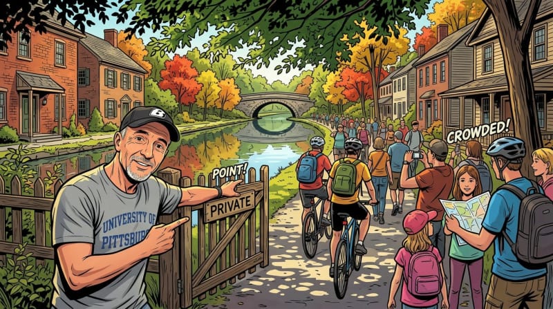
The towpath is not a private park for Pittsford residents. It belongs to the state and the region. On a summer weekend around Schoen Place, it can be crowded enough that the intimacy disappears. The parking situation near Carpenter Park can be chaotic when events are running. The canal is a genuine public amenity in a community that sometimes has complicated feelings about genuinely public things.
The canal is also noisy during peak season in ways you only understand if you live on it. Boat engines, generators on moored craft, the Sam Patch's narration carrying across the water. We hear all of it. None of it is a serious problem — it's the sound of a place being used — but it's different from what a day-tripper experiences, and anyone considering a canalside property should know that summer brings real sound with it.
And the canal path is not a substitute for the kind of built-out park system that growing communities invest in separately. The Erie Canal Nature Preserve and Carpenter Park are real assets; the broader park system in the village is not extensive. The towpath provides something parks don't, and vice versa, and both matter.
What Stays

What Stays
Here's what I've come back to after years of walking this path, cycling it, and floating on it.
The canal doesn't require anything of you. It doesn't ask you to be a customer, a subscriber, a member, a supporter. You show up and it's there. In a community where most of the things that bind people together — restaurants, events, commercial activity — require some kind of transaction, the towpath is one of the few places where the belonging is free.
You run into your neighbor. You see the same heron working the same section of bank it's worked for years. You watch the light change on the water from October to March to June. You learn what this place actually looks like in February, when it isn't trying to impress anyone.
From the water, floating along Schoen Place on a summer evening with music reaching you from the shore, the village looks different than it does from land. Smaller, somehow, and more complete. The canal is the edge of it, but it's also the middle — the thing that runs through the whole community without asking permission.
That's not a small thing. In a village trying to figure out what holds people together, the canal is doing some of that work quietly, every day, without anyone having to organize it.
It's worth paying attention to.
Content ID: DHtx5492Tjmrdcffaw8n0I2c
See an error? Tell us.