Designed for People: Bob Corby on Pittsford's Streetscape Gaps
The Short Version
- Pittsford's building hierarchy — South Main, Monroe Avenue, Schoen Place, worker housing streets — has survived suburban encirclement largely intact, which is rarer than most residents realize
- Monroe Avenue running a mile from the village center was the geographic accident that saved Pittsford from the strip-mall fate that overtook Victor and Penfield
- Suburban zoning is a two-dimensional exercise — use classifications and setback requirements on a map — and that is exactly why Pittsford's streetscape gaps exist where they do
- Street trees alone reduce vehicle speeds by 7–8 mph; lane widths of 10 feet or less actively discourage speeding without hurting traffic flow — the design choices are safety tools, not aesthetics
- The Bean Mill, Powers parcel, and the village's suburban office parks are the next infill decisions — and they will either extend the pattern Pittsford has preserved or become larger versions of the gaps we already have
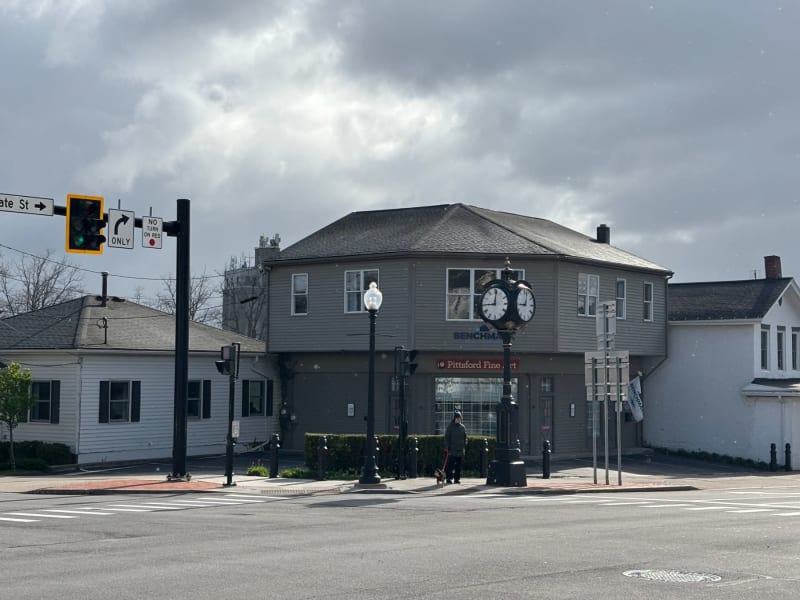
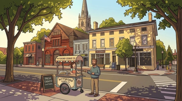
If you walk the loop many of us walk — Main Street south to Schoen Place, back up State Street, across the bridge and home — there is one corner that never quite fits. The northeast corner of Main and State, directly across from the Phoenix Building with its clock tower. A two-story commercial building sits behind four parking spaces, with curb cuts on both Main and State that let the driveway spill into what should be sidewalk. The street wall breaks. Something is missing, and the eye knows it before the mind catches up.
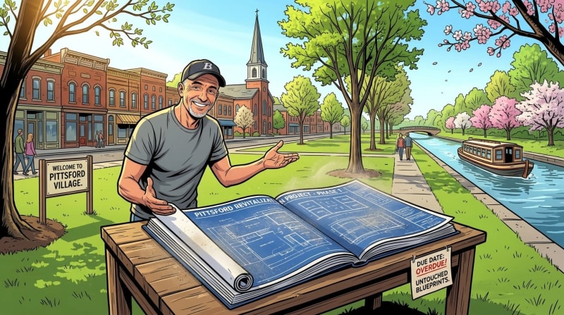
Bob Corby has been looking at that corner since he was a kid. He served 28 years as Mayor of Pittsford Village and has had a long career as an architect. Recently he has started producing AI-rendered visualizations of what the Pittsford Village streetscape could look like if we filled in the gaps. I sat down with him to walk through what he sees, why it matters, and what a village that takes its public space seriously actually does.
A Village That Held Its Pattern
A Village That Held Its Pattern
Bob has an exercise he recommends. Pull up an aerial view of Pittsford Village — Google Maps will do — and look at the building pattern before you look at anything else. What you see, if you know what you are looking at, is something that has almost entirely disappeared from the suburbs surrounding it.
There is a hierarchy. South Main Street has a certain type of building. Monroe Avenue has another. Schoen Place has its own entirely — quirky, compressed, distinctive in a way that rewards the people who walk or bike through it rather than the people who drive past. The streets that were once worker housing, Bountain Avenue and Wood Street, have theirs. Each zone has its own archetype, and the archetypes fit together into a coherent whole that you can read from the air as clearly as you can feel it on foot.
Most older villages in Monroe County once had something similar. They don't anymore. The suburban strip leaked in — a Tim Hortons drive-through here, a parking lot where a building should be there — and the pattern fragmented until what remained was indistinguishable from the commercial corridors surrounding it. Victor's Route 96 corridor is Bob's go-to example: twenty years of growth that looks, in his words, like somebody scattered dice on a table. No relationship between buildings. No logic to the street edge. Nothing that tells your body you are somewhere rather than nowhere.
Pittsford was saved from that fate largely by geography. Monroe Avenue — the commercial strip that in another town would have bled directly into the village center — runs a mile away. That distance was enough. The strip stayed the strip, and the village stayed the village, and the building pattern that existed before suburban development encircled it has remained largely intact.
Bob was in Munich not long ago and came back thinking about it. I've been twice — once backpacking, once with family — and the thing that strikes you about the city's postwar reconstruction is that the infill doesn't announce itself. Buildings clearly constructed in the 1950s and 60s sit alongside 19th-century neighbors and the street reads as continuous. The scale is right. The ground floors are transparent — shops and entries facing the sidewalk, not blank walls or parking. The buildings are contextual in the way that word is supposed to mean something, not just the way planners use it in meetings.
That is what responsible infill looks like. And it is, Bob argues, entirely achievable here — because the pattern we are filling into still exists. We are not trying to recover something lost. We are completing something that is still legible, still intact, still worth protecting.
The question is whether new buildings that go up in Pittsford's gaps are designed the way suburban zoning has always designed them — as shapes on a two-dimensional map, with setbacks and square footage and use classifications — or whether they are designed for the experience of the person walking past them. What does it feel like to walk by that building? Does it hold the street edge or break it? Does it belong to the block or sit apart from it?
Those questions don't appear on a zoning map. But they are, Bob would say, the only questions that actually matter.
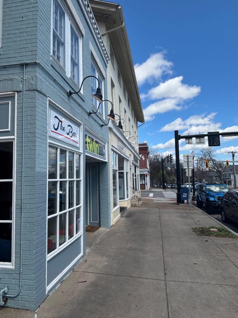
The Corner That Got Away
The Corner That Got Away
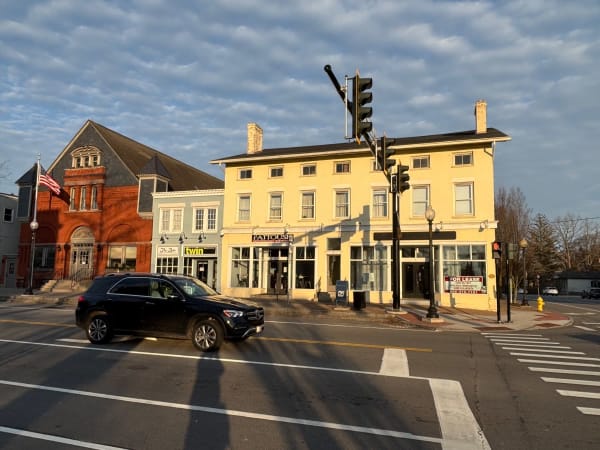
Of all the gaps in that pattern, the northeast corner of Main and State is the one Bob has been watching the longest. In the 19th century, Thomas Spiegel built carriages on the northeast corner — a blacksmith shop and buggy works at the edge of the Four Corners. That building burned. A craftsman-style gas station followed, which Bob remembers as genuinely attractive in its own right. Later gas stations came and went on the same site. What exists there today is a two-story commercial building set back behind four parking spaces — the setback itself a legacy of the site's gas station years, when no one built to the street because the pumps and the forecourt needed the room.
"That's always been the ugly corner of the Four Corners. And it's fundamental — we want a building there that has the architectural stature of the others."
The word stature did a lot of work in our conversation. Bob's point is not that the current building is ugly in an interesting way, or that it could be spruced up with better signage. His point is that the corner itself is too important to the identity of the village to be occupied by a building that doesn't engage the sidewalk, doesn't engage pedestrians, and doesn't hold up its end of the architectural conversation that the Phoenix Building, the library, and the historic storefronts across the street carry on without it.
The current building fails on the counts that make commercial buildings work in traditional village centers. It sits back from the street. Its entrances are hard to find. The four parking spaces out front generate conflict — Bob remembers near-misses when the spaces were full and drivers were pulling onto the sidewalk to squeeze in. The parking lot is, in his phrase, a big ugly void at the most visible corner of the most visible intersection in the village.
What Could Be There Instead

What Could Be There Instead
This is where Bob's renderings come in. He has been producing visualizations of the corner as it could be — and they answer a question the village has been asking quietly for decades.
His first version is a two-and-a-half story clapboard commercial building pulled right to the sidewalk. Ground-floor storefronts with generous windows. Upper-floor residential above. A gabled roof with dormers, shutters, and awnings in the color palette the village already uses. The building engages the sidewalk on both State Street and Main, turning the corner the way corner buildings in traditional villages always have.
"You could even put some parking under the building if you combined it with the lot next door."
The attorney's office immediately next to the Michaels parcel was built in 1969, outside the historic character of the block. Bob's proposal is to think of the two parcels as a single development opportunity — a larger footprint, parking tucked underneath, and a three-story building of the kind that traditional villages do so well.
His second rendering tests exactly that — a full three stories, arched ground-floor storefronts, hanging signage, a building with the kind of presence the corner has been asking for.
"A three or three-and-a-half story building would be totally appropriate there. It would be an exciting opportunity for somebody. Condos above, commercial below, right in the center of town. More people living on Main Street. That's how traditional villages stay alive."
The renderings are visualizations, not proposals in front of any board. But they do the thing that no zoning document or planning memo can do — they let you see it. They answer the question what if? with an image precise enough that you stop arguing about abstractions and start arguing about specifics.
"Every street, especially in the core, should be treated like a park — a public space, a place where people want to be."
— Bob Corby
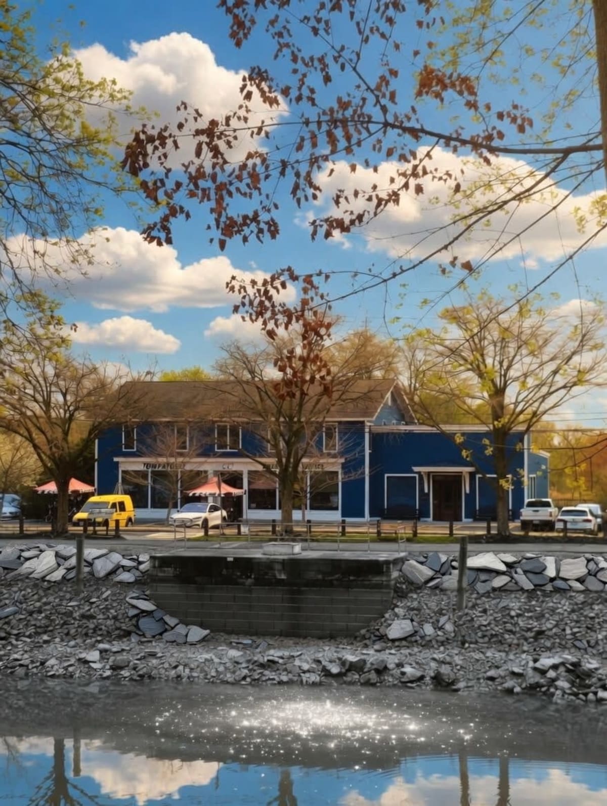
Defining the Edge - Current View near Pittsford Pub
Defining the Edge - Current View near Pittsford Pub
Step back from the one corner and Bob's larger thesis emerges. A village isn't made of buildings. It's made of the space between buildings — the street itself — and what defines that space as something human-scaled and walkable rather than something you drive through at thirty-five miles per hour.
Most of the gaps in Pittsford's streetscape exist for the same reason: they were designed on a map. Suburban zoning is a two-dimensional exercise — a parcel gets a use classification, a setback requirement, a square footage limit, and that is considered sufficient. Nobody is required to ask what it will feel like to walk past the result. Nobody has to think about whether the building holds the street edge or breaks it, whether it faces the sidewalk or turns its back to it, whether the person on foot is made to feel welcome or irrelevant.
Bob's argument — and it is an argument about process as much as aesthetics — is that you cannot design a functioning village center from a map. You have to think in three dimensions. You have to stand on the sidewalk, mentally or literally, and ask what this street is going to feel like when the building is there. That question has a right answer. And the tools to find it are not complicated.
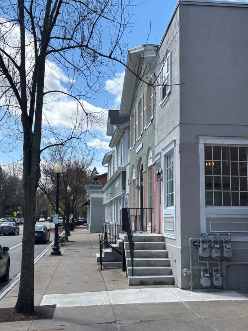
Imagine an appropriate street-facing building near the Pittsford Pub

Imagine an appropriate street-facing building near the Pittsford Pub
Bob calls this defining the edge. In traditional urban design, the edge of the street is defined by three things working together: the buildings themselves (pulled to the sidewalk with active ground-floor uses), the street trees (creating a canopy that visually narrows the corridor), and the details in between — pedestrian-scale lighting, benches, plantings, the thousand small things that tell your body you are in a place rather than on a road.
None of this is aesthetic preference. It is engineering. According to Dan Burden's widely-cited research on urban street trees, adding street trees and on-street parking to a corridor can bring vehicle speeds down by seven to eight miles per hour without any change to the speed limit or enforcement. The trees do the work. Your body perceives the narrowed visual corridor and your foot eases off the gas.
Lane width does similar work. NACTO's Urban Street Design Guide is explicit: lane widths of ten feet are appropriate in urban areas and have a positive impact on safety without hurting traffic flow. In select cases, nine to nine-and-a-half foot lanes can be used effectively. Wider lanes — the twelve and thirteen foot lanes that the New York State Department of Transportation has historically pushed — correlate with higher speeds and, critically, with worse pedestrian outcomes.
Those outcomes are not abstract. AAA Foundation research on pedestrian injury shows that the average risk of death when a pedestrian is struck by a vehicle is about ten percent at twenty-three miles per hour. It rises to twenty-five percent at thirty-two miles per hour. At forty-two miles per hour, it reaches fifty percent. The twelve mile-per-hour difference between what Monroe Avenue is designed for and what drivers would travel on a narrower, tree-lined version of the same street is the difference between a survivable crash and a fatal one.
"Why wouldn't you do everything possible to make traffic go as slowly as possible? Every property in the village benefits from walkability — especially the businesses. The whole success of our brand is dependent on people being able to walk around the Four Corners."
Filling in the Other Streetscape Gaps

Filling in the Other Streetscape Gaps
The northeast corner is the most visible streetscape gap, but it is not the only one. Bob walked me through the others.
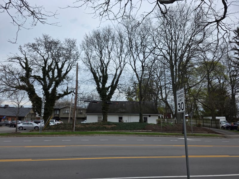
On State Street, the former Starbucks space — briefly Rachel's, now vacant — shares a long building with Village Bakery, adjacent to the former Phoenix Hotel. The combined building sits behind a small parking lot with a strange setback. The setback is historical: the original alignment of State Street curved around a small village green with a horse trough and a women's temperance drinking fountain, and when the street was realigned in the 1920s, the buildings on that block ended up oddly placed relative to the new right-of-way. The distinctive chimney on the former Starbucks end of the building is actually a remnant of a livery barn and blacksmith shop that served the Phoenix Hotel before burning down — the chimney was preserved and built into what eventually became Pittsford's first automobile garage on that site. Bob's suggestion there isn't to tear anything down. It's to add a porch or a landscaped patio that would re-establish the street edge without the loss of the historic building.
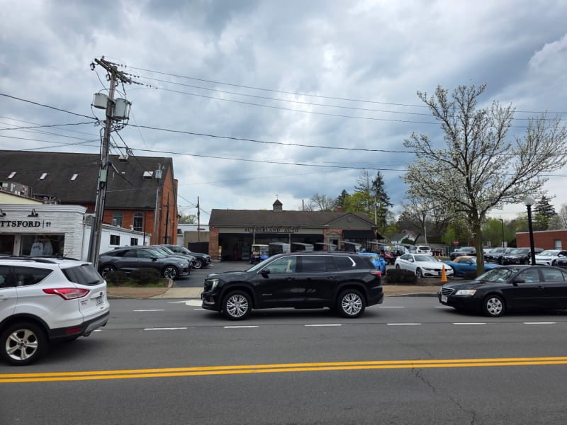
On Monroe Avenue, the Sutherland Automotive used car lot sits directly across from the Parker block. It's another gap in the streetscape — a parking arrangement where a building belongs. Bob's vision: a bar building at the frontage, parking consolidated in the rear, and a use that fills the gap as you approach the Four Corners. He has floated the idea that the Town of Pittsford could use a site like that for a Town Hall annex — filling a civic need and completing the streetscape in one move.
On North Main Street, near the Pittsford Pub, another pair of suburban-style buildings turn their backs to the street. Bob sees commercial on the ground floor and apartments above — the traditional village pattern that has worked for two centuries.
Each of these is a separate conversation with separate property owners and separate complications. But they share a common framework: the village streetscape has predictable gaps, and the gaps can be filled with buildings that do the things traditional village buildings have always done.
The Comp Plan Already Agrees

The Comp Plan Already Agrees
Here is the part that surprised me most when I started looking: the village's own planning documents already make Bob's argument. The 2019 Village of Pittsford Comprehensive Plan — adopted when Bob was still in office and the result of extensive public process — calls explicitly for continuing to improve the streetscape and pedestrian experience within the Village center. The Village Center Business (VCB) zoning district exists, in the language of Chapter 210 of the Village Code, to recognize the special significance of the Four Corners and the Main Street and State Street commercial corridors as the central spines of the greater Pittsford community.
The tools are in place. The planning board and the Historic Preservation Board have decades of track record transforming marginal proposals into buildings that strengthen the streetscape. Bob pointed to example after example — the house across from St. Louis that was proposed as a McMansion and ended up fitting the block. The Pittsford Community Library, originally designed to sit in the middle of a parking lot, pulled to the street where a three-story hotel had historically stood. His own work at the Pittsford Farms Dairy.
"The library alone, in the first drawings, looked about like Henrietta's library."
And there is the slow patient work that rarely makes the news. During his 28 years as mayor, Bob walked the village with DPW staff every year and planted between ten and twenty new street trees — filling gaps the state DOT had created when its policy was to remove any tree within thirty feet of a curb. He pushed for pedestrian-scale lighting on the major corridors, the twelve-foot poles that line Monroe Avenue and South Main instead of the airport-style cobra lights that announce a highway. Small things, compounded annually, over decades.
"The streetscape is everything. You can imagine Monroe Avenue without those trees. It would still carry the same traffic. But it wouldn't be livable."
Why Design Matters
Why Design Matters
I asked Bob, near the end of our conversation, what he wished more people understood about this work. His answer didn't hesitate.
"People don't understand the importance of design."
When Bob was growing up in Pittsford, Penfield looked like Pittsford. Victor looked like Pittsford. All three were traditional village centers with historic architecture, pedestrian scale, and coherent streetscapes. Over the next half-century, Penfield and Victor made different choices — or failed to make any choices at all — and today they are busy suburban intersections that are, in Bob's honest assessment, probably not retrievable to what they once were.
Pittsford made different choices. The Historic Preservation Board was created. Design standards were written into the code. Architects and planners who understood classical proportion and regional vernacular served on boards that said yes, no, and not-quite-yet to what got built. The village that exists today is the cumulative result of those choices — not any one of them, but all of them together, compounding over generations.
Bob's point about the corner at Main and State is, in the end, a point about all of it. A proper building on that corner is not a nice-to-have. It is the logical extension of the work the village has been doing for fifty years. The renderings are not fantasies. They are what could exist if the pattern we have already established is allowed to continue.
As a village, we have a comprehensive plan that says this. We have a code that enables it. We have planning and historic preservation boards that understand it. We have examples, going back decades, of buildings we almost got wrong and fixed. What we are waiting for, I think, is a public conversation clear enough to turn intention into action.
The stakes of that conversation are about to get concrete. The most significant development opportunities in the village's near future are already visible. The Bean Mill and Schoen Place, with the Powers parcel, represent the kind of infill moment that defines a village's trajectory for a generation — a large site, an active corridor, an opportunity to add density and activity in exactly the place the village pattern calls for it. Done well, it extends Schoen Place's distinctive character rather than interrupting it. Done poorly, it becomes another gap in the pattern, just a larger one.
Bob would add the office parks to that list. The suburban office parks that ring the village center were built for a world of work that no longer exists in the same form. He sees them as candidates for hybrid redevelopment — limited commercial on the ground floor, housing above, more people living close enough to the Four Corners to walk there. That is not a radical idea. It is the traditional village pattern applied to a new problem.
These are not hypothetical conversations. They are the decisions coming toward the village whether the village is ready for them or not. The question Bob has been asking for fifty years — are we designing for the person on the sidewalk, or just filling in a map? — is about to get some very specific answers.
What do you see when you walk past that corner now? And what would change about the way you experience the Four Corners, if the building that should be there actually were?
Content ID: tlVo2j5Vbs4e47fjhrsGESYC
See an error? Tell us.
Comments
Share with the Community