Wegmans Hit the Trail Passport: Pittsford's 8 Designated Routes Explored
The Short Version
- Pittsford's eight Wegmans Hit the Trail Passport routes connect the Erie Canal Towpath to wooded side trails most residents drive past without knowing they're there.
- Monroe County maintains over 90 miles of designated trails, and Pittsford's section links directly into the Erie Canalway National Heritage Corridor — 360 miles spanning 14 New York counties.
- The towpath crowds peak between 9 a.m. and noon on summer Saturdays; arriving before 8 a.m. gives you the path nearly to yourself.
- September and October offer the passport season's best tradeoff: cooler temperatures, thinner crowds, and fall color on the wooded routes.
- Two routes per Saturday, spread across six weekends before October, is comfortable pacing for almost any family wanting to complete all eight.
There's a moment on the second mile of the Erie Canal Towpath — somewhere between the hum of a passing kayak and the shadow of the lift bridge at Schoen Place — when it stops feeling like exercise and starts feeling like home. Pittsford residents have been walking these routes informally for decades. The Wegmans Hit the Trail Passport gives the whole Pittsford trail network a name, a purpose, and a reason to finally explore the routes most of us have driven past but never walked.
National Trails Day 2026 falls on June 6. That makes this the perfect week to pick up a passport — or to remember why you started one last May and set it down sometime in July.
What Is the Wegmans Hit the Trail Passport?
What Is the Wegmans Hit the Trail Passport?
Monroe County Parks maintains over 90 miles of designated trails across its parks system. The Hit the Trail Passport was developed in partnership with Wegmans to put a frame around that network — to turn a sprawling collection of paths into something completable, collectible, and worth celebrating.
The program works simply. Pick up a physical passport at participating Monroe County park locations, then collect stamps at designated kiosks along each route. Complete all the designated routes in your region and earn a commemorative patch. The season typically runs May through October, though the canal towpath stays accessible and enjoyable well into fall.
Pittsford is among the most-used hubs in the county system. Eight routes are designated within the village and its immediate surroundings, ranging from the wide, flat towpath that most Pittsford residents already know to wooded side trails that most haven't found yet. Passports are available at Monroe County Parks offices and select participating locations — check the Monroe County Parks website for current pickup spots before making the trip.
What the passport does that a trail map can't: it gives you a reason to go. Pittsford has always had these paths. The passport turns "we should walk more" into a specific, completable goal with a deadline and a reward.
The 8 Pittsford Passport Routes at a Glance
The 8 Pittsford Passport Routes at a Glance
The eight routes cover a meaningful range of terrain and ability levels. The Erie Canal Towpath is the anchor — paved, flat, and accessible to strollers, wheelchairs, and leashed dogs. The supporting routes branch into woodland terrain and residential connector paths that link back to the canal corridor.
A few things worth knowing before you schedule your Saturday:
Several routes connect end-to-end, meaning a motivated family can string two or three together without returning to the car. The towpath itself runs west toward Bushnell's Basin and east toward Fairport, giving you the option of a longer linear walk if you leave a second car at the far end.
Dog-friendly designations apply to most routes. Stroller accessibility is highest on the paved towpath sections and open connectors; wooded routes with natural surfaces are passable but require more attention underfoot. The Monroe County Parks trail listings carry current accessibility ratings and any seasonal closures — conditions change faster than printed guides, and it's worth confirming before you drive to a trailhead.
The specific route names, trailhead addresses, and exact mileage live on the Monroe County Parks website. Download the current passport route PDF before you go — the county's version is always more current than any third-party source.
Which of the eight is the one you've been putting off?
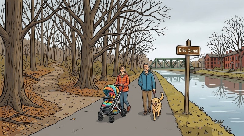
Erie Canal Towpath: The Anchor Route
Erie Canal Towpath: The Anchor Route
Start here.
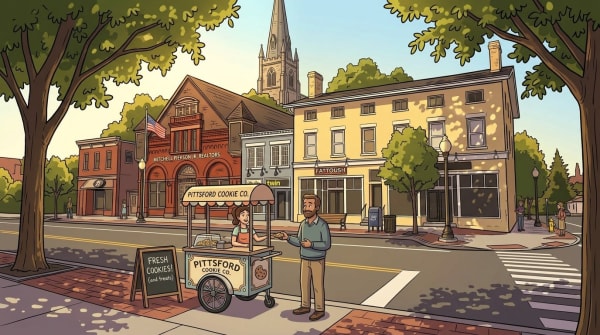
The towpath through Pittsford runs from Schoen Place west toward Bushnell's Basin and east toward Fairport — a corridor that carries everything distinctive about this village. The surface is paved and flat. That means it works for everyone: kids on bikes, parents with strollers, older walkers who have no interest in a root-crossed path through the woods.
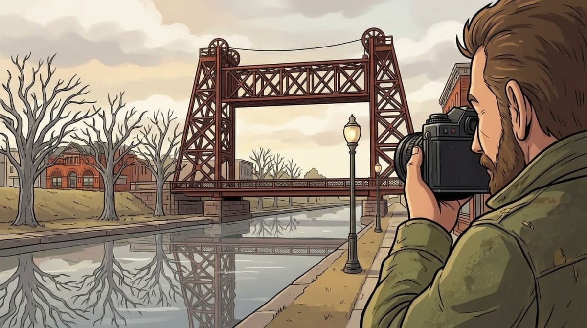
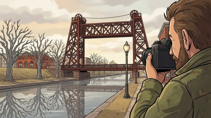
The lift bridge at Schoen Place is the visual anchor. It's been photographed by every local photographer who ever picked up a camera, and it earns that attention every time. On a summer morning the light hits the water differently than anywhere else in the county. Canal boats navigate the same corridor they've traveled for two centuries. Lock 32 — a working piece of Erie Canal infrastructure — still raises and lowers water levels on schedule, and draws more sustained attention from visiting children than most playgrounds I've seen.
Parking at Schoen Place is the most straightforward access point, though the lot fills on summer weekends by mid-morning. Side streets near the village center put you within a short walk of the trailhead. Lock 32 has an alternate parking area that most first-timers drive past without noticing.
Pittsford's section of the towpath is part of the Erie Canalway National Heritage Corridor — a 360-mile multi-use trail spanning 14 counties across New York, connecting the Hudson Valley to the Great Lakes. Most people walking through Schoen Place never think about that scale. But knowing you're walking a corridor that stretches the width of the state changes what the path feels like underfoot.
"The canal was built by hands from every part of New York. It still belongs to everyone who walks it."
Three Routes Worth the Extra Miles
Three Routes Worth the Extra Miles
The towpath gets the attention, and it deserves it. But the passport program was designed to push you past it — into the parts of Pittsford's trail network that most residents drive by without knowing they're there.
Three of the eight routes stand out as the ones people typically complete last. Not because they're difficult, but because the canal is so accessible and familiar that the other routes require a small act of intention to reach.
That intention is worth it.
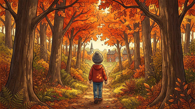
The wooded routes in the network offer what the towpath doesn't: tree cover, elevation variation, and the specific quiet of a trail narrow enough that you walk single-file for stretches. Spring on these sections means wildflowers in the understory — trout lilies, trillium, and bloodroot along the sections that drain slowly and stay damp through May. Fall means the deep yellow-red canopy that happens when maple and oak mix overhead on a narrow path.
Some of these routes are out-and-back; a few work better as point-to-point walks if you have a car shuttle. The Monroe County guide specifies which is which. My general advice: plan for the shuttle on any route over three miles one-way if you're bringing young kids. An eight-year-old who was enthusiastic at mile one is a different person at mile six on the return.
The routes with the most elevation change are also the most rewarding in autumn. The canal is beautiful in fall. But the ridge sections — where you're actually climbing for a stretch — give you views back toward the village that the flat corridor never offers.
What gifts do these side trails offer that the towpath doesn't? Mostly: slower time. The specific attention that arrives when the path narrows, the noise drops, and there's nothing to do but walk.
Tips for Completing All 8 (Before Summer Ends)
Tips for Completing All 8 (Before Summer Ends)
Completing all eight Pittsford passport routes by October is realistic for almost any family — comfortable if you spread it across six weekends rather than trying to sprint through the list.
A realistic Saturday: two routes. Maybe three if they connect end-to-end. More than that and the last route starts to feel like a chore rather than a walk, which defeats the whole point. The stamp at the end matters less than the Saturday itself.
Knowing when to go matters almost as much as knowing where. Here's the Rochester weather picture across the passport season, based on NOAA climate normals:
July and August peak in warmth — and in canal crowding. September and October offer cooler temperatures and noticeably thinner crowds on the towpath, with fall color as a bonus on the wooded sections. May is underrated: cool enough to move quickly, with wildflower season just opening on the wooded stretches.
The canal towpath crowds peak between 9 a.m. and noon on summer Saturdays. Early mornings — before 8 a.m. — give you the path nearly to yourself, with better light and cooler air in July and August. Weekday evenings from 5–7 p.m. are the other quiet window.
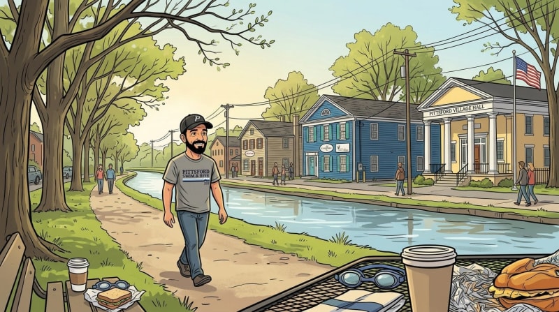
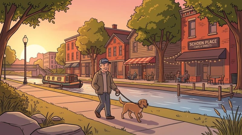
When you finish a route — or the day — Schoen Place is the obvious stop. Village restaurants and cafés sit within easy walking distance of the canal trailhead, which is the kind of proximity that turns a recreation program into a community ritual. The Rochester–Canandaigua Trail connects further into the regional network if you've still got energy and miles left.
The passport season runs May through October. If you want all eight stamps, start before July. August fills faster than it should, and September is shorter than you think.
What would it mean to know all eight of these routes by name — to know where the shade starts on the wooded stretch, where the canal goes quiet past the lock, where your dog always stops? That kind of knowing is what turns a place into yours.
Content ID: AC8CtTMCcD0axfDVI04rHDWE
See an error? Tell us.